Is a “waterfront” home in Stonington the same as a “water view” listing? Not quite. The wording in a description can shape your everyday use, insurance costs, and even what you can build or repair near the shoreline. If you love this coast, it pays to read the fine print.
In this guide, you’ll learn how agents in the Stonington and greater Southeastern Connecticut region typically use “waterfront,” “water view,” and “water access,” plus what to verify before you fall in love. You’ll get a clear checklist for showings, a quick photo guide, and links to authoritative resources. Let’s dive in.
Quick definitions buyers can trust
Waterfront
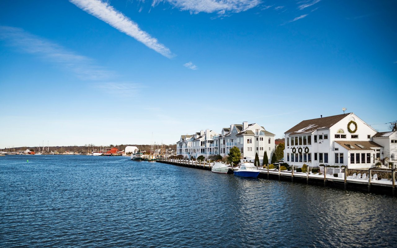
A “waterfront” parcel touches the water’s edge with no public road in between. In practice, that means direct shoreline adjacency and usually private access. Listings may say “direct waterfront,” “on the water,” or note frontage on a named cove, river, or Long Island Sound.
What to verify:
- The exact boundary relative to the mean high water line. In Connecticut, private ownership often ends at mean high water on tidal coasts.
- Shoreline type and condition: natural edge, riprap, or a bulkhead.
- Any public trust interests, recorded easements, or paths along the shore.
Water view
“Water view” means you can see the water but the parcel does not necessarily touch it. The view might be across a street, from an upper floor, or from a rise in the yard. There is no presumption of private access.
What to verify:
- Distance to the shoreline and how you would reach it day to day.
- Whether the view is secure or could be blocked by future construction on a neighboring lot.
- Whether any deeded right of access exists.
Water access
“Water access” provides use of the water without owning shoreline frontage. Access can be private and deeded, shared through an association dock or ramp, or nearby via public facilities.
What to verify:
- The exact legal instrument that creates the access, such as a recorded easement or HOA covenants.
- Rules, fees, parking, and whether slips or moorings are assigned or first come.
- Maintenance and insurance responsibilities for shared structures.
Property rights and access to confirm
Boundaries, mean high water, and rights
On tidal waters in Connecticut, the state’s public trust interests often begin seaward of the mean high water line. That affects docks, floats, and any work at the water’s edge. Ask for a recent survey showing property lines, shore monuments, and elevations.
You also inherit riparian or littoral rights, which involve reasonable water use and can be shaped by state and municipal rules. If shoreline rights are central to your plans, consult an attorney during due diligence.
Easements, covenants, and associations
Shared ramps, beaches, and docks are governed by recorded easements or HOA rules. Request the deed, the recorded easement language, HOA bylaws, and any meeting minutes that mention access, slip allocation, waiting lists, and parking.
Docks, seawalls, and permits
Shoreline structures commonly require permits from state and sometimes federal authorities. In Connecticut, the Department of Energy and Environmental Protection (DEEP) oversees coastal permits and tidal wetlands. Confirm that any existing dock, pier, bulkhead, or riprap was permitted and that there are no open violations. Start with DEEP’s guidance on coastal resources and permitting through the CT DEEP Coastal Resources page.
Public versus private shoreline
Even if your parcel meets the water, a public right-of-way can cross or border it. Check for recorded paths or town rights near the shore. The assessor’s records, land records, and surveys should clarify these details.
Must-have documents during due diligence
- Recent survey or plot plan with elevations
- Full deed, title report, and recorded easements/covenants
- Association documents if applicable
- Permit history for all shoreline structures
- Any prior flood or engineering reports and claims history
Insurance, mortgages, and coastal risk
Flood zones and insurance
Lenders typically require flood insurance if a building footprint lies in a Special Flood Hazard Area, such as FEMA zones AE or VE. Premiums are influenced by your elevation, foundation type, and an elevation certificate prepared by a licensed surveyor. Look up the parcel’s flood map panel at the FEMA Flood Map Service Center.
Private flood insurance can be an alternative to the National Flood Insurance Program, depending on coverage and price. Always compare quotes and terms.
Elevation and construction
In coastal VE zones, building codes often call for elevated foundations on pilings or columns and breakaway walls to reduce wave damage. Local enforcement relies on Base Flood Elevation plus any required freeboard. An elevation certificate is essential for accurate underwriting.
Wind and hurricane coverage
Coastal Connecticut policies may carry separate wind or named-storm deductibles. Some carriers limit coastal exposure or require higher deductibles. Ask for the full policy, not just a summary, and confirm wind and hail coverage.
Appraisal and lending
Appraisers consider shoreline condition, foundation type, and coastal risk. New construction near the shore can face higher costs due to pilings and elevation, which in turn affects lending and budgeting.
Lifestyle tradeoffs in Stonington
If you want daily, direct water use
Waterfront living puts the shoreline at your door. You can launch a paddleboard, swim when conditions allow, and enjoy privacy if access is truly private. You will also take on more maintenance, from seawall upkeep to post-storm cleanup.
If the view matters most
A water-view home gives you the visual amenity with fewer exposure and maintenance demands. Insurance is often simpler and less expensive. If boating is important, plan on using a public launch, an association dock, or a mooring.
If you want access without full ownership
Shared or deeded access can be a sweet spot. Costs are usually lower than direct waterfront, though rules and availability matter. Expect sign-ups, possible waiting lists for slips or moorings, and shared assessments for dock repairs.
Showings photo guide and checklist
Bring your phone and take clear photos that help you verify details later. If you make an offer, these images are useful to surveyors, insurers, and contractors.
Photo checklist:
- Wide shot of the house-to-water relationship to confirm distance and grade
- Overhead or marked survey image that shows parcel lines relative to the shoreline
- Closeups of bulkhead, riprap, seawall, or natural marsh edges for condition
- Dock, float, or gangway construction details and the path from the house
- Representative water views from main rooms, morning and evening
- Foundation and grade markers that show elevation relative to the shore
- Association dock, ramp, parking, and posted rules if shared
Showing questions to ask:
- Is this truly “waterfront,” “water view,” or “water access,” and can I see the recorded documents that prove it?
- Where are the property lines in relation to the mean high water line according to a recent survey?
- Do dock, ramp, or seawall structures have permits, and who maintains and insures them?
- What flood zone is the home in, and is there an elevation certificate?
- Are moorings or slips assigned, fee-based, or first come? Any waiting lists?
Red flags in listing language
- Vague “access to water” with no deed or recorded easement reference
- “Private dock” mentioned, but no permit history or ownership details
- No recent survey or “measurements approximate” near the shoreline
- Shoreline work described with no mention of permits or inspections
- “Subject to tide” without explaining seasonal or intertidal exposure
Planning tools and local due diligence
For flood exposure, start with the FEMA Flood Map Service Center to identify zones and map panels. For long-term sea level and surge scenarios, try the NOAA Sea Level Rise Viewer. For permits and tidal wetlands guidance, review the CT DEEP Coastal Resources pages, then confirm local permit requirements with the town before any work.
When you need public access for boating or launching, check town facilities in Stonington Borough, Mystic, and Pawcatuck. Availability and rules vary by site and season.
What to do next
- Confirm the property type you are buying: waterfront, water view, or water access.
- Order a survey and request an elevation certificate if flood risk is possible.
- Ask for recorded easements, HOA bylaws, and shoreline permit histories.
- Get quotes for homeowner, flood, and wind coverage.
- Use FEMA and NOAA tools to understand current and future risk and plan improvements accordingly.
If you would like a second set of eyes on a Stonington-area listing or a curated list of waterfront, view, and access options, we are here to help. Our design-led process, drone imagery, and regulatory fluency make the details simple and the presentation strong. Connect with Jonathan Shockley to request a complimentary home consultation.
FAQs
What is the difference between waterfront and water view in Stonington?
- Waterfront touches the water with no road between and usually allows direct private shoreline use, while water view offers the sightline without touching the shore or guaranteeing access.
Do I need flood insurance for a water-view home?
- It depends on the home’s location relative to FEMA flood zones; check your panel at the FEMA Flood Map Service Center and verify with an elevation certificate.
Can I add a new dock to a waterfront property?
- Possibly, but you will need to confirm eligibility and obtain permits through state and local authorities, including CT DEEP and local commissions.
How secure is my water view over time?
- Views can change if a neighboring lot builds or adds height; ask whether adjacent parcels are buildable and review local zoning and any view easements.
What documents prove shared water access rights?
- Look for a recorded deeded easement and association covenants that detail rights, rules, maintenance, and parking for shared facilities.